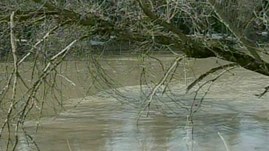
Ramara Township facing "imminent flooding"
Ramara Township employees are going door-to-door warning residents of imminent flooding. The Black River reached capacity at about 5:30 a.m. this morning.
The town says water levels are expected to rise about six inches per day.
“Our update from the Trent Severn Waterway indicates that we will be expecting flooding in our south end any time after 11 a.m. today,” said Ramara Fire and Rescue Services deputy fire chief Tony Stong.
Stong says with Canal Lake at capacity, they need more water to flow into Lake Simcoe through the Trent Severn Waterway. He says homes between Lock 38, 37, and Lake Simcoe should “expect flooding levels similar to the levels seen in 2008 in this area.”
Fire chief Dave McCarthy says the effect will be worse in Gamebridge first before areas around the Black River.
“We are continually monitoring our situation in the northern end of the township and have strategically placed sand and sand bags,” he said in a news release.
Kawartha Lakes closes roads because of flooding
The Ministry of Natural Resources has issued a flood warning in the Kawartha Lakes area.
The warning is in effect for the Burnt, Irondale, Gull and Black River areas.
The City of Kawartha Lakes issued a news release today warning a coming storm could bring more rain than area waterways can handle.
The following roads are closed due to flooding:
- Fairbairn Road (local traffic only) to the east at Cedar Tree Rd and the west end at civic address 708
- CKL Road 34/Cameron Road at Chamber’s Rd. (south end) and Powles Rd. (north end)
- Prospect Rd. between Eldon Station Rd and Palestine Rd.
- King’s Wharf Rd at the Emily Creek bridge between Centreline Rd. and Sturgeon Rd. 7
Temperatures are expected to stay warm over the next few days, with daytime highs of about 10C.
A big weather system is set to move into the province this weekend and bring more than 50 millimetres of rain to the Kawartha Lakes area this weekend.
It could bring almost 100 millimetres of rain over five days.
Kawartha Lakes public works and fire rescue staff and will be filling sandbags today. Residents in the Burnt River area can pick them up at the Burnt River depot.
Meanwhile, a flood watch for the Kawartha Conservation watershed remains in effect.
Parry Sound - Muskoka watch
The Ministry of Natural Resources is warning residents in Parry Sound and Muskoka to watch for flooding.
The MNR issued a flood watch today, saying there is potential for flooding and is urging residents to keep a close watch on conditions and to regularly check for updates.
Water levels are expected to continue rising in the coming days. A significant potential exists for flooding with the forecasted rainfall, the MNR says.
Residents who live in flood-prone or low-lying areas should consider taking measures to protect their property.
The MNR says it is closely monitoring the situation.
The current forecast is calling for up to 45 millimetres or more of rain this weekend and temperatures in the range of 6C to 13C with near freezing nighttime temperatures.
The water content in the snowpack continues to be above normal, the MNR says.
Grey Sauble flood update
The warmer weather experienced Thursday triggered a steady release of water from the snowpack, says Grey Sauble Conservation.
The conservation group says flows responded quickly to the snow melt bringing in the highest flows of the spring so far. Flows are within seasonal norms for now, except for the Sauble River, where flows are above normal and rising.
The river systems are at risk of rising further as a big storm tracks toward the area.
The system has the potential to drop more than 50 millimetres of rain over the weekend.
Nottawasaga Valley Conservation Authority warning
The Nottawasaga Valley Conservation Authority is warning of flooding.
Water levels in the lower Nottawasaga River downstream from the Minesing Wetlands and Wasaga Beach are reaching critical levels, the NVCA says. They are continuing to rise.
Flows in other watercourses remain high, the NVCA says, and a flood watch issued April 7 remains in place.
The NVCA says a warning is a notice that flooding that could be damaging to life and property is imminent or happening.
Springwater Township road floods
Glengarry Landing Road South has been closed from Highway 26 to Ronald Road because of flooding.
The combination of rainfall and melting snow and ice has caused the Nottawasaga River to rise and breach its banks, Springwater Township says.
The town’s public works department is watching water levels closely and will reopen the road when it can.
Lake Simcoe Region Conservation Authority watch continues
While widespread flooding isn’t anticipated in the Lake Simcoe region, the conservation authority is warning flooding in low-lying areas is imminent.
The ground throughout the watershed is saturated and there is snowpack remaining in the northern half of the watershed. The LSRCA says flooding is possible in low lying and flood prone areas because of runoff from the rainfall and snowmelt.
The LRSCA says the flood watch will stay in place through Wednesday, April 16.